Bribie Island Calm Side Walk, Queensland. Australia
This morning we replaced the city bustle with an island paradise complete with stretches of white sandy beaches, azure waters and stunning wildlife. You can explore precious havens of open woodlands, scrubby coastal heaths bursting with spring and autumn wildflowers and fragrant paperbark wetlands. Stretch out on golden beaches with curving sand dunes offering picturesque sea views and the chance to see dolphins frolicking in the water. Paddle a kayak past black-necked storks and mangrove honeyeaters in the coastal lagoons or throw a fishing line among the sandbars and tidal flats of this ever-changing sand landscape.
Normally we would take our 4WD and enjoy a daytrip or last minute beach getaway. We always felt refreshed by the salt air as we toured the beautiful expanse of beach, passing freshwater lagoons offering a perfect spot to stop and cool off. Every now and then pull over, sit back, relax and enjoy the sun and sand with friends.
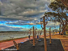
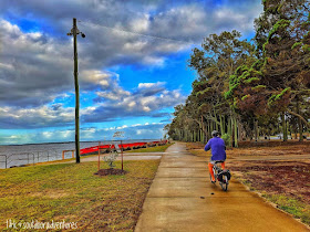
Instead of the 4wd we explored by foot following a flat easy walk of about 7km return. The shady path hugs the seafront through continuous parkland to the Bribie Island Bridge and beyond and is ideal for families and those who want a leisurely walk without any close encounters with lycra gang.
We started at the car park on the far southern reach of Bongaree. The first few hundred metres are fairly exposed as at this point there’s just a path with the esplanade on one side and low-lying dunes on the other. From here it’s a delightful walk through picnic areas, benches, playgrounds and beside tiny strips of white-capped beach. Bribie Island was once a major wartime command post with a fortresses and batteries up and down the beach on the surf side, the remnants of which remain today. And it was off the coast about forty miles from here that a Japanese sub sunk the Centaur hospital boat. On the Bongaree side an old wartime storage depot can be seen on Welsby Parade and along the path there are reference plaques to war time activity.
The west side of Bribie Island is known as the ‘Passage Side’ as it runs alongside Pumicestone Passage. This side of the island also has lots of great beaches. Though the beaches tend to be narrower and less picturesque than those on the east of the island, the sand tends to slope more gently into the water
The path continues under the bridge and on to Sylvan Beach where there’s a chirpy talking history monument worth having a listen to, and beyond are more playgrounds, a mangrove boardwalk and a kiosk over the water. After several hundred metres the path enters a private estate, at this point turn and retrace. The calm side has views of the stunning Glasshouse Mountains. Back at the start, around the corner at Buckley’s Hole is a bird hide which is a likely view spot for some of the 350 species of bird that call Bribie Island home. (Buckley’s Hole Section No Dogs Allowed)
Another walk is the 3.8km circuit of Bribie Island Bicentennial Trails, which begin at the Bribie Island Community Arts Centre on Sunderland Drive Bribie Island. The sandy track features Banksia, Palm Grove, and Melaleuca Bribie Island walks which branch-off the main circuit giving visitors the chance to enjoy strolls through eucalypt forests, paperbark wetlands, and even wallum heathlands. (Also No Dogs Allowed).


No comments:
Post a Comment